How Is Wind Formed Class 9?
What Is Wind?
Wind is the movement of air from an area of high pressure to an area of low pressure. It is caused by differences in atmospheric pressure, which are due to uneven heating of the Earth’s surface by the Sun. As warm air rises, an area of lower pressure is created. Cooler surrounding air rushes in to fill this void, creating wind.
Wind always blows from areas of high pressure to areas of low pressure. It acts to equalize the pressure differences across the planet. The greater the difference in pressure, the faster the wind will blow as air rapidly moves from high to low pressure in attempt to reach equilibrium.
How is Air Pressure Created?
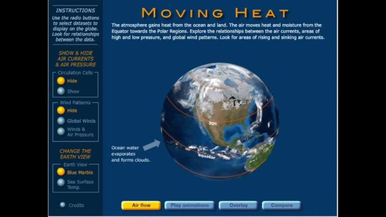
The heat from the sun warms up the Earth’s surface unevenly. This creates different air temperatures around the world. Hot air is less dense and rises up into the atmosphere, creating an area of low air pressure. Cooler, denser air sinks down to the Earth’s surface, creating an area of high air pressure. These areas of high and low pressure create air pressure systems.
Places where sunlight directly hits the ground the most become warmer and the air rises creating low pressure areas. Places not getting as much direct sunlight stay cooler, and the air sinks creating high pressure zones. The differences in air pressure cause air masses to move from high to low pressure which creates wind.
Three Types of Pressure Areas
There are three main types of pressure areas that affect wind formation:
High Pressure Areas
High pressure areas (or highs) are characterized by sinking air. The air becomes compressed as it sinks, causing the pressure to increase. The increased pressure pushes air outward from the high pressure zone. Therefore, winds tend to blow clockwise outward from high pressure areas in the Northern Hemisphere.
Low Pressure Areas
Low pressure areas (or lows) are characterized by rising air currents. As the air rises and expands, the pressure drops, creating a low pressure zone. Air gets pulled inward to replace the rising air, causing winds to blow counterclockwise toward low pressure areas in the Northern Hemisphere.
Wind Equalizing Pressure
Wind flows from areas of high pressure to low pressure because it always seeks to equalize differences in pressure. The greater the difference in pressure between two areas, the faster the wind speed trying to balance the pressure. The movement of wind from high to low pressure creates much of the weather we experience.
Wind Direction
Wind direction refers to the direction from which wind originates. Winds flow from areas of high atmospheric pressure to areas of low atmospheric pressure. This is due to air moving to equalize the pressure differences between these high and low pressure zones.
On a global scale, wind direction is also influenced by the rotation of the Earth and the Coriolis effect. The Coriolis effect causes winds in the Northern Hemisphere to curve to the right and winds in the Southern Hemisphere to curve to the left. This results in the formation of major prevailing winds at latitudes around 30-60 degrees, such as the polar easterlies, mid-latitude westerlies, and trade winds.
At a local level, wind direction is modified by local geography. Features like mountains and valleys can channel winds in certain directions, resulting in local winds like mountain breezes, valley breezes, and land/sea breezes that differ from the prevailing wind patterns.
High and Low Pressure Systems
High and low pressure systems are regions in the atmosphere that have different air pressures relative to surrounding areas. This difference in pressure is caused by the unequal heating of Earth’s surface. High and low pressure systems are important in understanding wind formation and weather patterns.
High pressure systems, or highs, are characterized by descending air. The air sinks and becomes denser, increasing the atmospheric pressure below. High pressure systems feature clearing skies and light winds. The descending air acts like a dome over the high pressure area and traps air inside, preventing cloud formation. Highs bring sunny, calm weather.
Low pressure systems, or lows, are characterized by rising air. The warm air rises and expands, decreasing the atmospheric pressure below. This rising air cools and condenses into clouds and precipitation as it ascends vertically. Lows are associated with stormy weather like rain, snow, thunderstorms, and strong winds. The rising air acts like a chimney, drawing surrounding air inward and upward, resulting in the winds we feel around low pressure zones.
Land & Sea Breezes
Land and sea breezes are local winds that result from the temperature difference between land and sea. During the day, the land heats up more quickly than the sea, so the air above the land becomes warmer and less dense than the air above the sea. This causes the warmer air over the land to rise, creating an area of lower pressure. The higher pressure, cooler air over the sea then moves in to replace the rising warm air, creating a sea breeze blowing from the sea onto the land.
At night, the opposite happens. The land cools more quickly than the sea, so the air above the land becomes cooler and denser than the air above the sea. This causes the cooler air over the land to flow outwards and move over the sea, creating a land breeze blowing from the land out to sea.
On coastlines, regular land and sea breezes combine to create daily onshore and offshore wind cycles. The sea breeze typically develops around late morning to early afternoon as the land heats up, reaching peak strength in late afternoon. The land breeze usually develops after sunset as the land cools down, reaching peak strength around dawn.
Monsoons are essentially larger scale land and sea breezes. In summer, strong heating of continental land masses creates an area of intense low pressure that draws in cooler, moisture-laden air from the ocean in the form of onshore monsoon winds. In winter, the land cools faster than surrounding oceans, creating high pressure systems that generate strong offshore monsoon winds.
Mountain & Valley Winds
Winds in mountainous regions are greatly affected by the uneven heating and cooling of the sloped terrain. During the day, the mountain slopes heat up more quickly than the valleys, causing air to rise up the slopes. At night, the slopes cool rapidly, while the valleys retain heat longer. This temperature difference leads to the formation of regular winds.
Mountain slope winds blow upslope during the day as air is heated and upslope at night as air cools and descends. Valley winds blow downslope during the day and reverse direction at night. The downslope mountain winds are often strong and gusty, while the upslope valley winds are usually gentle breezes.
Katabatic winds are winds blowing down a slope, created at night by the cooling of air on high ground. The air becomes colder than the surrounding air at the same elevation, which makes it sink down the slope. Anabatic winds are the reverse – winds blowing up a slope during the day as mountain slopes are heated by the sun.
Understanding these regular local winds in mountainous areas is important for activities like flying small aircraft, ballooning, and hang gliding. The winds can also influence local weather patterns and the moisture in valleys.
Global Wind Patterns
The Earth’s rotation on its axis combined with the heat of the Sun creates global wind patterns. There are three major global wind cells – the Hadley cell, the Ferrel cell, and the Polar cell. Each cell creates a different prevailing wind pattern:
- The Hadley cell extends from the equator to around 30° latitude in both hemispheres. As warm air at the equator rises, it flows poleward. Then it cools, sinks, and returns equatorward along the surface. This circulation creates the tropical easterly trade winds that blow from the northeast in the Northern Hemisphere and from the southeast in the Southern Hemisphere.
- The Ferrel cell sits between 30° and 60° latitude in both hemispheres. The circulation here creates westerly winds in the middle latitudes that blow from the southwest in the Northern Hemisphere and from the northwest in the Southern Hemisphere. These are known as the prevailing westerlies.
- The Polar cell covers the area from 60° to the poles. Air that sinks at around 60° flows back toward the poles along the surface, creating the polar easterly winds that blow from the northeast in the Northern Hemisphere and from the southeast in the Southern Hemisphere.
Additionally, narrow bands of very strong winds called jet streams form at the boundaries of the Hadley and Ferrel cells. Jet streams can reach speeds over 250 mph and have a large influence on weather patterns.
Measuring Wind Speed
There are two main ways to measure wind speed:
An anemometer is a device used for measuring wind speed. It consists of a rotating mechanism with 3 or 4 cups or cones that catch the wind. The rate of rotation is proportional to the wind speed. Anemometers can measure wind speeds of just a few meters per hour to over 100 mph. They are an accurate scientific instrument commonly found at meteorological stations.
The Beaufort scale is a system for estimating wind speed based on visual observations. It was created in 1805 by Admiral Sir Francis Beaufort of the British Navy. The scale goes from 0 to 12, with each number associated with a wind description like “light breeze” or “violent storm” along with visual cues like movement of trees and waves. While not as precise as an anemometer, it allows rough measurement of wind speed when an anemometer is not available.
Importance of Understanding Wind
Wind plays a vital role in many aspects of our lives and planet. Understanding wind patterns and forces is crucial for several reasons:
Weather and Climate: Winds drive weather patterns and influence climate around the world. Surface winds transport heat and moisture which affects precipitation. Upper level winds like jet streams steer storm systems and impact weather events.
Ocean Currents: Surface winds combined with the Earth’s rotation drive major ocean current circulations like the Gulf Stream. Ocean currents regulate global climate by transporting warm and cool water between regions.
Agriculture: Wind impacts many farming activities including seed dispersal, soil erosion, crop stress from wind damage, and irrigation. Monitoring local wind conditions helps farmers protect crops and manage operations.
Construction: Architects and engineers must account for wind forces when designing buildings, bridges, and other structures. Wind load calculations are performed to ensure constructions can withstand certain wind speeds and gusts.
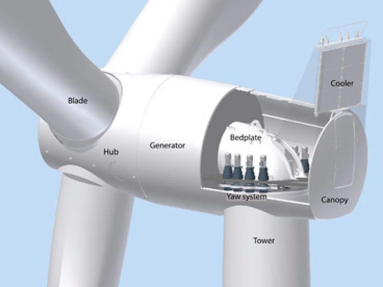
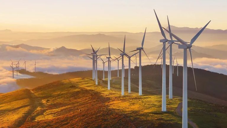
Renewable Energy: Wind energy is a rapidly growing renewable source for electricity generation. Understanding wind patterns, speeds, and durations allows optimal siting and efficiency of wind turbines.
In summary, comprehending wind dynamics and effects has far-reaching significance across meteorology, climate, oceanography, agriculture, engineering, renewable energy, and many other fields.