What Causes Wind And How Does It Flow?
What is Wind?
Wind is the movement of air from an area of high pressure to an area of low pressure. It is caused by differences in atmospheric pressure, which pushes air from high to low pressure zones. Wind flows due to the rotation of the Earth and the sun heating the atmosphere unevenly. As air warms, it rises, creating a low pressure area. Cooler surrounding air then rushes in to fill the void, creating wind flow.
The greater the difference in pressure between two points on the Earth’s surface, the stronger the wind flow. Wind speed and direction are also influenced by global wind patterns, landscape, and weather events. But fundamentally, wind exists because air moves from high to low pressure zones. This movement of air is what we experience as wind.
Global Wind Patterns
The rotation of the Earth affects global wind patterns in a profound way. As the Earth rotates on its axis, the atmosphere is also dragged westward by the spinning motion. However, areas near the equator are moving faster than areas near the poles due to the difference in circumference around the Earth’s wider belly vs narrow tips. This causes winds to curve relative to the ground surface. The resulting major global wind belts are known as the trade winds near the equator, the westerlies in the mid-latitudes, and the polar easterlies near the North and South poles.
The trade winds blow from the northeast in the Northern Hemisphere and the southeast in the Southern Hemisphere. These steady tropical winds occur between 30 degrees north/south latitudes and the equator. As air moves across the equator it is deflected toward the west. This sets up a wind circulation pattern where air moves toward the equator in the upper atmosphere, sinks down, and flows back toward the poles near the surface.
In the mid-latitudes around 30-60 degrees north/south are the prevailing westerlies. These high-altitude winds blow from the southwest in the Northern Hemisphere and the northwest in the Southern Hemisphere. As air flows toward the poles it is turned eastward by the Coriolis effect. The westerlies enable much of the world’s air travel routes and impact weather across the global mid-latitudes.
Near the North and South poles are the polar easterlies where cold dense air flows outward from the poles and is turned westward by Earth’s rotation. However, the polar easterlies are quite variable as they interact with transient weather systems.
Local Wind Patterns
On a local scale, winds are driven by temperature differences across the landscape. During the day, the sun heats up the land faster than the nearby bodies of water. The warm air over the land expands and rises, while the relatively cooler and denser air over the water rushes in to take its place. This causes a breeze to blow from the water onto the land. This is known as a sea breeze or lake breeze.
At night, the opposite effect takes place. The land cools down faster than the water, so the cool air over the land sinks and flows out over the water. The warmer air over the relative warmer water then rises and moves onto land. This reverses the local winds, creating a land breeze.
Similarly, during the day, the slopes of mountains heat up in the sun faster than the nearby valleys. The warm air rises up the mountains, drawing the cooler air from the valleys uphill. At night, the mountain slopes cool faster than the valleys, reversing the air flow downslope.
High and Low Pressure Systems
Air pressure is not uniform everywhere on Earth. There are regions of high pressure, where the air sinks and spreads out, and regions of low pressure, where the air rises. The direction that air flows from these pressure systems is what creates wind.
In regions of high pressure, the air at the surface is dense and sinks down towards the ground, forcing air outwards along the surface and creating an area of relatively calm weather. High pressure systems rotate clockwise in the Northern Hemisphere due to the Coriolis effect. As the dense air spreads out along the surface, it creates light surface winds moving outwards from the high pressure zone.
In contrast, low pressure systems have less dense air that rises up through the atmosphere, drawing air inwards across the surface to replace it. This convergence of air results in characteristic wind patterns that swirl counterclockwise inward toward the low pressure in the Northern Hemisphere. The rising air can also create cloud formation and precipitation as it cools at higher altitudes. The edge of a low pressure system is where the strongest winds are found.
The movement of air between regions of high and low pressure drives much of our weather and determines the direction of prevailing winds across the globe and locally. Tracking highs and lows allows meteorologists to forecast wind conditions and other weather patterns.
Wind Speed
Wind speed refers to the rate at which air is moving past a fixed point. It is a key component in understanding wind patterns and impacts. Wind speed is primarily affected by three main factors:
Pressure Gradient
The difference in atmospheric pressure between two locations creates what is known as a pressure gradient. Air will move from areas of high pressure to areas of low pressure. The greater this pressure difference, the faster the wind speed.
Coriolis Effect
As wind travels across the Earth’s surface, it is deflected sideways by the rotation of the Earth. This is known as the Coriolis effect. In the Northern Hemisphere, it causes winds to curve to the right. In the Southern Hemisphere, winds curve to the left. The Coriolis effect impacts wind speed and direction.
Friction
The friction between air and the Earth’s surface slows wind down. Features like mountains, trees, and buildings create additional friction and turbulence, further reducing wind speed. Friction from the ground generally decreases wind speed, with higher winds at higher elevations.
Measuring Wind Speed
There are a few main ways we measure wind speed:
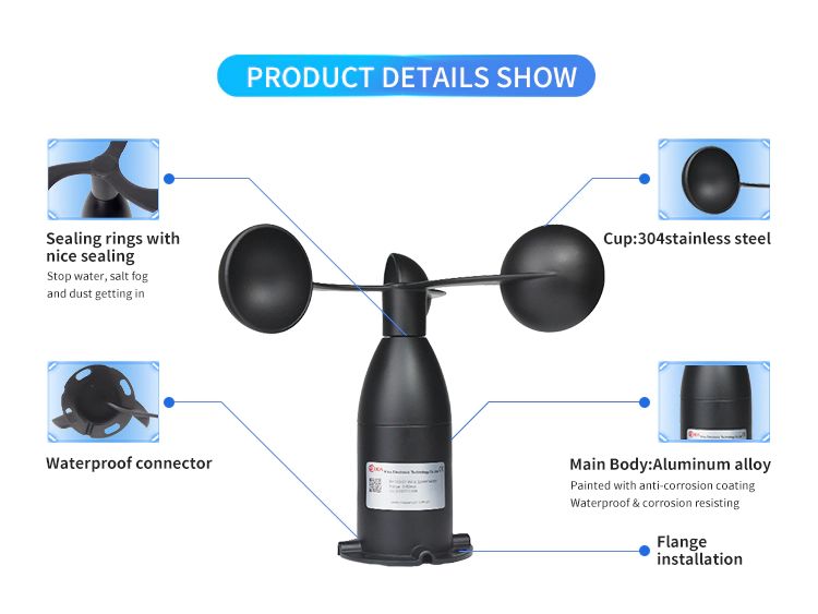
Anemometer – An anemometer is a device used for measuring wind speed. It is commonly constructed with 3-4 cups or cones that spin around a vertical pole as the wind pushes into them. Counting the revolutions per minute allows the anemometer to calculate the wind speed. Some anemometers have electrical contacts that transmit pulses as the cups spin, allowing them to interface with data loggers or displays. Anemometers provide a quantitative measurement of wind speed.
Beaufort Scale – The Beaufort Scale is a qualitative ranking system used to estimate wind speed based on visual observations. For example, wind speeds of 0-1 mph correspond to “calm” conditions on the Beaufort Scale. Wind speeds of 13-18 mph are classified as a “Moderate Breeze”. And wind speeds over 73 mph are classified as a “Hurricane”. The Beaufort Scale allows people to get a general sense of wind conditions without needing measurement instruments.
Both anemometers and the Beaufort Scale have their uses. Anemometers give precise wind speed measurements, which are needed for meteorology and wind energy. But the Beaufort Scale is simpler and can be easily used by anyone to estimate the winds.
Forecasting Winds
Meteorologists have several techniques for forecasting wind conditions. Weather maps show current temperature, air pressure, precipitation, and wind speed across a region. Tracking changes in high and low pressure systems indicates where winds are likely to strengthen or shift direction.
Weather balloons provide detailed wind profiles by recording conditions at different altitudes as they ascend through the atmosphere. Sending up balloons twice daily gives valuable data on wind trends over time.
Sophisticated forecast models also factor in measurements from weather stations, historical climatology, and satellite imagery. These computer simulations predict weather patterns including expected wind behavior based on current atmospheric conditions.
By combining observed data and model output, weather services can issue forecasts that give people time to prepare for changing wind conditions. Advance notice of high winds allows precautions to be taken to secure property, adjust travel plans, and prevent potential accidents or injuries.
Impacts of Wind
Wind can have significant impacts on the environment, infrastructure, and human activities. Some of the main impacts of wind include:
Wind Energy
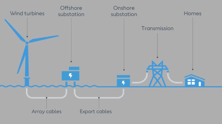
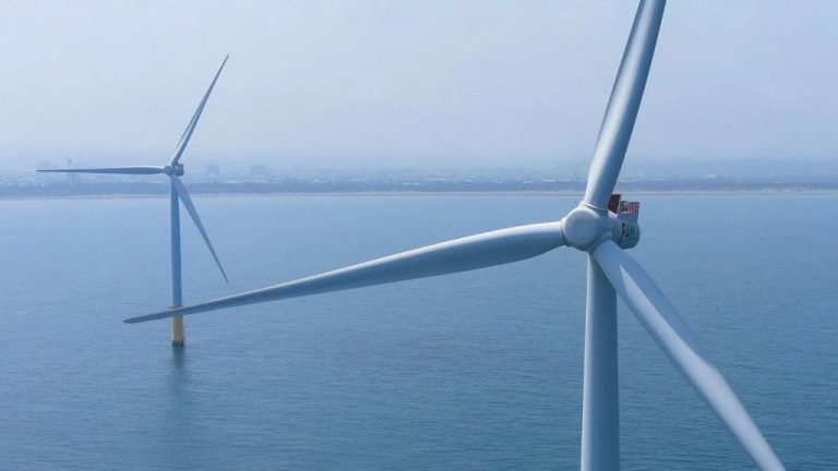
Wind is used as a renewable source of energy in wind turbines. The kinetic energy of wind is converted into mechanical power to generate electricity. Wind power is one of the fastest growing renewable energy sources worldwide.
Erosion
Strong winds can pick up soil and sand particles, contributing to erosion over time. Wind erosion affects areas with loose, dry topsoil and sparse vegetation like deserts and agricultural lands.
Wind Damage
Powerful winds can damage buildings, vehicles, trees, power lines and other infrastructure. Hurricane-force winds and tornadoes can be especially destructive. Preventative measures like storm shutters can help reduce wind damage.
Wind Chill
Wind chill refers to how cold air temperatures feel on exposed skin due to wind. High winds can accelerate heat loss from the body, causing the air to feel colder than the actual temperature. Wind chill is a significant hazard in cold climates.
Funneling Effects
Wind can increase in speed and turbulence when it encounters obstacles that funnel or constrict its flow. This funneling effect commonly occurs around mountains, buildings, bridges, and other structures that force the wind to accelerate as it squeezes through a narrow passage. The Venturi effect describes how fluid flow through a constricted section speeds up, according to the principle of conservation of mass.
When wind encounters a mountain range, the mountains force the wind to rise up and over the peaks. As the wind flows up and over the mountains, it speeds up due to the Venturi effect. Mountain ranges like the Rockies in North America and the Andes in South America are well-known for creating strong, gusty winds on their downwind sides. These funneling winds can be hazardous for aviation and dangerous for structures that are not built to withstand the higher wind speeds.
Cities with tall skyscrapers can also create a funneling effect. The buildings block the wind at ground level, causing it to accelerate between the high-rises. Chicago and New York are examples of cities infamous for their “urban canyons” that funnel fierce winds between buildings. Bridges and ravines can similarly channel winds and lead to locally higher wind speeds.
When designing structures like buildings and bridges in areas prone to high winds, engineers must account for potential funneling effects to ensure the structures can withstand the elevated wind speeds. Proper orientation and reinforcement are necessary so these man-made structures do not get damaged by the winds they inadvertently intensify.
Wind Shear
Wind shear refers to a sudden change in wind speed or direction over a short vertical distance. It typically occurs at low altitudes near airports, where one layer of air is rapidly moving over another layer traveling at a different velocity. Wind shear can be extremely hazardous for aircraft that are taking off or landing. As an aircraft transitions from one wind speed and direction to another, it experiences a shift in the forces acting upon it. This can cause the plane to rapidly gain or lose altitude, pitch up or down, or roll from side to side.
One common type of wind shear that pilots are trained to be aware of is the microburst – a column of sinking air that causes rapid changes in winds near the surface as it descends. Microbursts often happen during strong thunderstorms. As rain falls through dry air beneath a thunderstorm, it evaporates and cools the air, making it denser than its surroundings. This cold air starts descending rapidly and spreads out horizontally when it hits the ground, creating powerful gusty winds emanating outward from the impact zone. An aircraft flying through this area can experience a sudden increase in headwinds followed rapidly by strong tailwinds. This can cause a dangerous loss of airspeed and lift.
Wind shear has contributed to several major airline crashes in the past, so pilots today receive intensive training on how to detect and react to it. Airports use weather radar, wind profilers, and other technology to identify wind shear conditions and warn pilots. However, total avoidance is not always possible, making wind shear awareness an important safety issue in aviation.

