How Deep Is Geothermal Heat In Wisconsin?
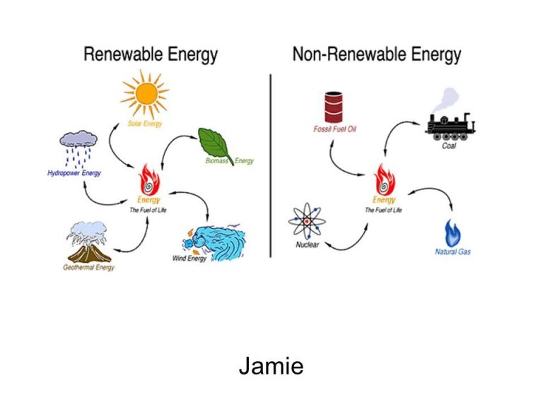
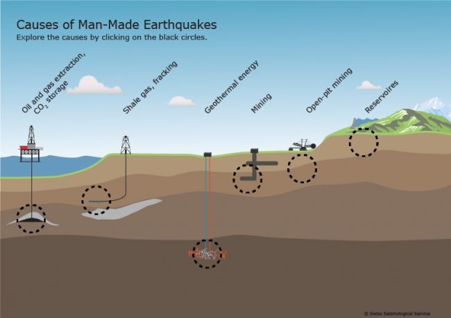
Geothermal energy is thermal energy generated and stored in the Earth. It arises from the original formation of the planet, from radioactive decay of minerals, and from solar energy absorbed at the surface. Geothermal energy can be accessed by drilling water or steam wells in areas where the resource is concentrated near the surface, or by drilling deep wells to access hot rock at depth and using the energy to generate electricity.
Wisconsin has moderate geothermal resources compared to western states, however there is still potential to utilize this renewable energy source through ground source heat pumps and direct use applications. Determining the depth and temperatures of geothermal resources across the state can help assess the potential for future geothermal energy development. This analysis aims to model the geothermal gradient under Wisconsin and estimate depths required to reach key temperatures for electricity generation.
Geology of Wisconsin
Wisconsin has a diverse bedrock geology, with different rock units having varying thermal conductivities based on their composition (Meyer, 2013). The state can be divided into five main geological provinces: the Lake Superior Lowland consisting of Precambrian igneous and metamorphic rocks, the Penokean Volcanic Belt with Precambrian metamorphosed volcanic and sedimentary rocks, the Wisconsin Dome underlain by Precambrian granite, the Paleozoic Plateau made up of Paleozoic sedimentary rocks, and the Western Uplands with Paleozoic sandstones (https://minds.wisconsin.edu/handle/1793/66658).
The thermal conductivity of common Wisconsin rocks varies significantly, with values ranging from 1.34 W/m-K for the St. Peter Sandstone to 6.15 W/m-K for the basalt of the Duluth Gabbro Complex (Meyer, 2013). In general, metamorphic and igneous rocks like granites and gneisses have higher thermal conductivity than sedimentary rocks like sandstones and carbonates. However, conductivity depends on specific mineral composition and porosity.
For example, the Precambrian granite batholiths of central Wisconsin have thermal conductivity around 3 W/m-K, while the sandstones of the Cambrian have values of 1.5-2.5 W/m-K (https://minds.wisconsin.edu/bitstream/handle/1793/66658/MS_Thesis_MeyerLauren.pdf?sequence=3). The conductivity of these units is an important factor in determining subsurface heat flow across Wisconsin.
Measuring Geothermal Gradient
The geothermal gradient refers to the rate of increasing temperature with depth within the Earth’s interior. It is typically measured in degrees Celsius per kilometer of depth (°C/km), although it can also be expressed in kelvins per kilometer (K/km) or millikelvins per meter (mK/m) (Wikipedia). The geothermal gradient varies across different locations on Earth, but generally falls within the range of 20-30°C/km in normal continental crust.
There are several techniques used for measuring geothermal gradient (Colorado Geological Survey):
- Direct measurement in boreholes using temperature sensors at various depths
- Estimation from conductive heat flow measurements
- Calculation from rock thermal conductivity lab measurements
Borehole temperature logging provides the most accurate in situ measurements of geothermal gradient. Sensors are lowered down the borehole to log temperature at regular depth intervals. The temperature data is then used to calculate the geothermal gradient over the depth section.
Geothermal Gradient in Wisconsin
Studies have been conducted to measure the geothermal gradient across different parts of Wisconsin. Research by Meyer (2013) found that the average geothermal gradient in Wisconsin is estimated to be below 20 K/km, lower than the continental average of 25-30 K/km (source). However, the gradient can vary spatially based on the underlying geology.
In northern Wisconsin, the gradient is around 15–17 K/km, while in southern Wisconsin it ranges from 19–25 K/km. The lower gradients in the north are attributed to the thicker, more insulating sedimentary cover. In contrast, southern Wisconsin has a thinner sedimentary cover and more heat-producing radioactive elements in the basement rocks, increasing the geothermal gradient (source).
Overall, the geothermal gradient tends to increase from north to south in Wisconsin, with some localized variations. Factors like rock thermal conductivity, radioactive heat production, and thickness of sedimentary cover affect the gradient.
Modeling Geothermal Heat Flow
Geothermal heat flow models and simulations have been used to estimate heat flow values and subsurface temperatures across Wisconsin. In 2018, a study by McDaniel used a radial heat flow model to create thermal conductivity profiles at various sites in the state (https://minds.wisconsin.edu/bitstream/handle/1793/77743/MS_Thesis_McDaniel_Adam.pdf?sequence=1&isAllowed=y). The models showed a geothermal gradient of around 18-25°C/km in southern Wisconsin, indicating temperatures of 50-60°C could be reached at 2-3 km depth.
More recently in 2023, a study by Montelli used an ice shelf and ice rise heat flow model to analyze the Wisconsin-Holocene glacial transition (https://tc.copernicus.org/articles/17/195/2023/). They found the average geothermal heat flux in Wisconsin to be around 65 mW/m2, but with significant spatial variations. The models help characterize heat flow despite sparse direct measurements in the state.
Overall, modeling efforts point to accessible geothermal heat resources at depths of 1-3 km in parts of Wisconsin. However, heat flow likely varies locally based on subsurface geology and aquifer properties. More measurements and high-resolution models are needed to fully characterize the geothermal potential across the state.
Depth to Reach Certain Temperatures
To determine the depth required to reach certain temperatures for geothermal applications in Wisconsin, we need to understand the geothermal gradient. The geothermal gradient refers to the rate of increasing temperature with depth within the earth. According to the Wisconsin Department of Natural Resources, the average geothermal gradient in Wisconsin is about 1°F for every 70 feet of depth [1].
This means that to reach 50°F, which is suitable for geothermal heat pump applications, you would need to drill down about 400 feet in Wisconsin. The typical ground temperature at 6-8 feet below the surface is around 55°F [2]. To reach higher temperatures of 120-150°F that could be used for direct heat applications, you may need to drill 1,500 – 2,000 feet deep or more.
However, the geothermal gradient can vary considerably based on location and geology. Areas with higher underground temperatures may require less depth, while areas with lower temperatures may require drilling much deeper than average. Precise depth calculations require subsurface temperature data from local well logs and heat flow models [3].
Geothermal Resources in Wisconsin
Wisconsin has some locations with geothermal reservoirs and hydrothermal sites that can be utilized for geothermal energy production. According to the Wisconsin Department of Natural Resources, the most significant geothermal reservoirs are located in southwestern Wisconsin, near the borders with Iowa and Illinois. These reservoirs are part of deep sedimentary basins filled with porous sandstone that contains hot water.
Some of the identified hydrothermal sites in Wisconsin include warm springs in Waukesha County, artesian wells at Beloit College, and deep aquifers in the eastern part of the state. The highest underground temperatures have been measured in southwestern Wisconsin, where geothermal gradients can reach up to 76°F per kilometer of depth. The geothermal reservoirs in this region are estimated to have temperatures above 150°F at depths of 3000 to 4000 feet.
Additional research is needed to fully characterize the geothermal resources available in Wisconsin. But the presence of deep sedimentary basins and warm aquifers shows promise for expanding the development of geothermal energy production in the state.
Challenges and Limitations
There are some challenges and limitations to utilizing geothermal energy in Wisconsin. The high upfront costs of installing geothermal systems is a major economic barrier for many homeowners and businesses. According to one Reddit user, the total cost for a single household after incentives can be around $20,000 for a horizontal loop system (Source:https://www.reddit.com/r/geothermal/comments/13d8hnw/geothermal_quote_in_wisconsin_where_to_go_next/). The initial investment is quite high compared to conventional HVAC systems.
There are also some technical limitations in certain parts of Wisconsin. The depth to reach adequate temperatures for geothermal heating and cooling can be prohibitive in some areas, especially in the northern part of the state. The geothermal gradient, which measures the increase in temperature with depth, can vary significantly based on the local geology. Areas with lower geothermal gradients require deeper wells to extract enough heat for a geothermal system. Drilling to depths greater than 400 feet adds considerably to the installation costs.
Overall, while geothermal energy has excellent potential in Wisconsin, the upfront costs and technical limitations in some areas remain challenges to wider adoption throughout the state.
Future Outlook
The future of geothermal energy in Wisconsin looks promising, with potential for growth as technology improves. According to researchers at the University of Wisconsin-Madison, enhanced geothermal systems could become viable in Wisconsin with new technologies (https://energy.wisc.edu/news/using-earth-battery-uw-madison-professor-touts-potential-geothermal-energy). While not currently economical on a commercial scale, emerging technologies like improved drilling techniques and advanced heat exchangers may enable deeper and more productive geothermal wells. Wisconsin’s geology lends itself well to geothermal systems with the right technological innovations.
Programs like Focus on Energy offer geothermal rebates and incentives in Wisconsin, which could boost adoption as costs come down (https://www.renewwisconsin.org/geothermal/). With increased investment and research at universities along with policy support, geothermal could grow as a locally-sourced renewable energy option. New geothermal installations paired with heat pumps and hybrid systems can provide sustainable heating and cooling for homes and businesses across Wisconsin. If technological hurdles are overcome, enhanced geothermal could provide utility-scale clean energy for the state. The future depends on creative solutions and strategic collaboration to tap into Wisconsin’s underground thermal resources.
Conclusions
In summary, the geothermal gradient in Wisconsin ranges from about 15-30°C/km, with an average of around 20°C/km. This means temperatures increase by approximately 20°C for every kilometer deeper you drill. While geothermal resources exist across the state, they tend to be deepest in the north and more shallow in the south.
Modeling studies estimate the depth to reach 60-100°C temperatures suitable for electricity generation to be around 2-4 km in southern Wisconsin and 3-6 km in northern counties. Direct use applications like geothermal heat pumps for buildings generally require shallower depths of 100-300 meters to exploit the earth’s near constant temperatures.
Overall, Wisconsin has moderate geothermal resources that could support expanded direct use for heating and cooling as well as some potential for power generation with deep drilling. However, exploration costs tend to be high and there are challenges reaching optimal temperatures in most regions of the state. Careful site selection and innovative technologies may improve the feasibility of geothermal energy as part of Wisconsin’s renewable energy mix going forward.